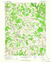
1964 Map of New Salem
USGS Topo · Published 1965About this map
Industrial activity and small coal-patch towns define this mid-century landscape in Fayette County. The map captures a transition in the local economy, where Coke Ovens (Abandoned) sit alongside active industrial sites like Rocks Works and numerous Mine Dumps. The region is densely interconnected by the Pennsylvania RR and Monongahela RR, which served the various settlements such as New Salem, Republic, and Keisterville. Local heritage is preserved in sites like the Old Toll House along the historic National Road and several family or parish burial grounds, including Tomasza Cem and Moore Cem.
Find a feature on this map
95 named features on this map. Tap any name to fly to it.
Don’t see what you’re looking for? This feature index may not catch every label — zoom into the map to look around manually.
Map Details
Editions of this 1964 New Salem Map
4 editions found
Other maps of this area

1900 · Uniontown
USGS Topo · 1:62,500

1900 · Masontown
USGS Topo · 1:62,500

1902 · Brownsville
USGS Topo · 1:62,500

1902 · Connellsville
USGS Topo · 1:62,500

1903 · Masontown
USGS Topo · 1:62,500

1906 · Brownsville
USGS Topo · 1:62,500

1931 · Brownsville
USGS Topo · 1:62,500

1931 · Connellsville
USGS Topo · 1:62,500

1931 · Uniontown
USGS Topo · 1:62,500

1931 · Masontown
USGS Topo · 1:62,500
Featured Places
- Luzerne Township, PA
- Redstone Township, PA
- Menallen Township, PA
- Franklin Township, PA
- German Township, PA