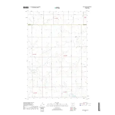
2017 Map of New Salem NE
USGS Topo · Published 2017About this map
The rolling hills of the North Dakota prairie define the landscape along the Oliver Co and Morton Co border. This region is characterized by a sparse, systematic grid of section roads like 33rd St and 40th Ave, reflecting the legacy of the Public Land Survey System. A focal point for local history is the Lutheran Bremen Cem, a small burial ground that serves as a quiet marker of the early settlement by German-Lutheran families in the area. The southern portion of the map is dominated by the waters of Sweet Briar Lake and its tributary, Sweetbriar Cr, which provide critical drainage and water resources in an otherwise semi-arid agricultural environment. The terrain is marked by gentle undulations and draws, typical of the Missouri Plateau, where the land is largely dedicated to grazing and dryland farming.
Find a feature on this map
25 named features on this map. Tap any name to fly to it.
Don’t see what you’re looking for? This feature index may not catch every label — zoom into the map to look around manually.
Map Details
Editions of this 2017 New Salem NE Map
This is the sole edition of this map. No revisions or reprints were ever made.
Other maps of this area

1954 · Bismarck
USGS Topo · 1:250,000

1954 · McClusky
USGS Topo · 1:250,000

1958 · Bismarck
USGS Topo · 1:250,000

1958 · McClusky
USGS Topo · 1:250,000

1960 · New Salem
USGS Topo · 1:24,000

1970 · New Salem NW
USGS Topo · 1:24,000

1970 · Judson
USGS Topo · 1:24,000

1970 · New Salem NE
USGS Topo · 1:24,000

1972 · Sweet Briar
USGS Topo · 1:24,000

1972 · Center
USGS Topo · 1:24,000