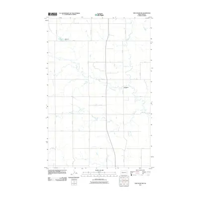
2011 Map of New Salem NW
USGS Topo · Published 2011About this map
Sweetbriar Creek meanders through this portion of Morton County, North Dakota, defining the drainage patterns of a landscape marked by a strict section-line road grid. The small settlement of Youngtown sits at the junction of 45th Ave and 33rd St, serving as a focal point for the surrounding agricultural community. In the northwest corner, the artificial reservoir of Mosbrucker Lake, created by Mosbrucker Dam, highlights the local importance of water management in this prairie environment. The geography is characterized by long, north-south avenues such as 48th Ave and 43rd Ave SW that connect scattered farmsteads across the undulating terrain.
Find a feature on this map
22 named features on this map. Tap any name to fly to it.
Don’t see what you’re looking for? This feature index may not catch every label — zoom into the map to look around manually.
Map Details
Editions of this 2011 New Salem NW Map
This is the sole edition of this map. No revisions or reprints were ever made.
Other maps of this area

1954 · Bismarck
USGS Topo · 1:250,000

1954 · McClusky
USGS Topo · 1:250,000

1958 · Bismarck
USGS Topo · 1:250,000

1958 · McClusky
USGS Topo · 1:250,000

1960 · North Almont
USGS Topo · 1:24,000

1960 · New Salem
USGS Topo · 1:24,000

1970 · Bluegrass
USGS Topo · 1:24,000

1970 · New Salem NW
USGS Topo · 1:24,000

1970 · Judson
USGS Topo · 1:24,000

1970 · New Salem NE
USGS Topo · 1:24,000