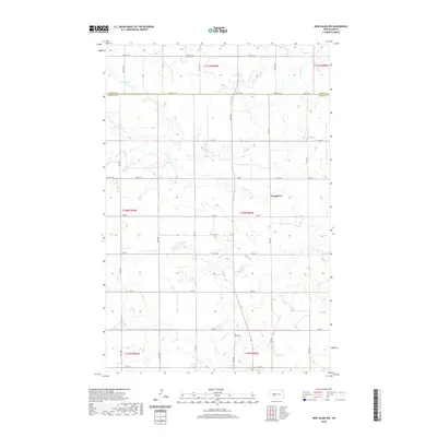
2020 Map of New Salem NW
USGS Topo · Published 2020About this map
Youngtown stands as a focal point in this portion of the North Dakota prairie, situated along the winding course of Sweetbriar Cr. The landscape is defined by the section-line grid of rural roads, including Co Hwy 140 and Co Rd 140, which navigate the undulating terrain of the Missouri Plateau. Near the northern boundary between Oliver Co and Morton Co, the waters of Mosbrucker Lake provide a rare hydrologic landmark in a region otherwise dominated by ephemeral drainage patterns. This map documents the persistent agricultural footprint and land division system that has shaped the Dakotas for generations, preserving the specific placement of farmsteads and rural infrastructure as they appeared in 2020.
Find a feature on this map
31 named features on this map. Tap any name to fly to it.
Don’t see what you’re looking for? This feature index may not catch every label — zoom into the map to look around manually.
Map Details
Editions of this 2020 New Salem NW Map
This is the sole edition of this map. No revisions or reprints were ever made.
Other maps of this area

1954 · Bismarck
USGS Topo · 1:250,000

1954 · McClusky
USGS Topo · 1:250,000

1958 · Bismarck
USGS Topo · 1:250,000

1958 · McClusky
USGS Topo · 1:250,000

1960 · North Almont
USGS Topo · 1:24,000

1960 · New Salem
USGS Topo · 1:24,000

1970 · Bluegrass
USGS Topo · 1:24,000

1970 · New Salem NW
USGS Topo · 1:24,000

1970 · Judson
USGS Topo · 1:24,000

1970 · New Salem NE
USGS Topo · 1:24,000