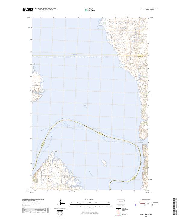
2024 Map of New Town SE
USGS Topo · Published 2024About this map
Lake Sakakawea dominates this landscape, covering a massive expanse where the Missouri River once flowed through its original valley. The creation of this reservoir redefined the region, as evidenced by the flooded inlets of Van Hook Arm and Lucky Mound Creek Bay. High ground is marked by prominent terrain such as Independence Point, which juts into the water where the river channel takes a sharp northward turn. The map captures a complex intersection of administrative boundaries, where McLean, Dunn, and Mountrail counties meet within the reservoir waters. Along the southern shoreline, Bia Rd 13 provides the primary land access to the rugged peninsulas and points that escaped the inundation, reflecting the enduring presence of the Mandan, Hidatsa, and Arikara Nation within the Fort Berthold Indian Reservation boundaries.
Find a feature on this map
15 named features on this map. Tap any name to fly to it.
Don’t see what you’re looking for? This feature index may not catch every label — zoom into the map to look around manually.
Map Details
Editions of this 2024 New Town SE Map
This is the sole edition of this map. No revisions or reprints were ever made.
Other maps of this area

1953 · Watford City
USGS Topo · 1:250,000

1957 · Watford City
USGS Topo · 1:250,000

1967 · Watford City
USGS Topo · 1:250,000

1967 · Raub NW
USGS Topo · 1:24,000

1967 · New Town SW
USGS Topo · 1:24,000

1967 · Parshall SW
USGS Topo · 1:24,000

1967 · New Town SE
USGS Topo · 1:24,000

1970 · String Buttes
USGS Topo · 1:24,000
1970 · Saddle Butte
USGS Topo · 1:24,000

1981 · New Town
USGS Topo · 1:24,000