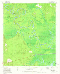
1981 Map of New Union
USGS Topo · Published 1981About this map
The Ouachita River meanders through a labyrinth of wetlands and oxbow lakes in this 1981 survey of the Arkansas timberlands. Within the Felsenthal National Wildlife Refuge, the river's complex hydrologic history is visible through features like Stormhole Bend, Caney Marais Bend, and Staveyard Bend. The landscape is dominated by riverine ecology, where the Saline River meets the Ouachita amidst a network of sloughs and brakes, including Boeuf Brake and Pine Island Slough.
Find a feature on this map
40 named features on this map. Tap any name to fly to it.
Don’t see what you’re looking for? This feature index may not catch every label — zoom into the map to look around manually.
Map Details
Editions of this 1981 New Union Map
2 editions found
Other maps of this area

1933 · Strong
USGS Topo · 1:62,500

1934 · Ingalls
USGS Topo · 1:48,000

1934 · Felsenthal
USGS Topo · 1:62,500

1934 · Moro Bay
USGS Topo · 1:62,500

1937 · Strong
USGS Topo · 1:62,500

1937 · Felsenthal
USGS Topo · 1:62,500

1937 · Ingalls
USGS Topo · 1:62,500

1938 · Felsenthal
USGS Topo · 1:62,500

1938 · Moro Bay
USGS Topo · 1:62,500

1939 · Felsenthal
USGS Topo · 1:62,500