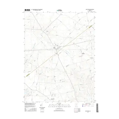
2016 Map of New Vienna
USGS Topo · Published 2016About this map
New Vienna sits at the intersection of local history and rural geography, straddling the border between Clinton Co and Highland Co. This 2016 survey highlights a landscape dotted with numerous small family and community burial grounds, including the Swingley Farm Cem, Shockley- Ross Cem, and Achor Cem, which serve as vital markers for genealogists tracing early residents of Green Township. To the east, the historic Gist Settlement and its accompanying Gist Cem remain as significant cultural landmarks.
Find a feature on this map
84 named features on this map. Tap any name to fly to it.
Don’t see what you’re looking for? This feature index may not catch every label — zoom into the map to look around manually.
Map Details
Editions of this 2016 New Vienna Map
This is the sole edition of this map. No revisions or reprints were ever made.
Other maps of this area

1907 · Blanchester
USGS Topo · 1:62,500

1917 · Hillsboro
USGS Topo · 1:62,500

1917 · Sabina
USGS Topo · 1:62,500

1917 · Sardinia
USGS Topo · 1:62,500

1943 · Sabina
USGS Topo · 1:62,500

1944 · Hillsboro
USGS Topo · 1:62,500

1944 · Sardinia
USGS Topo · 1:62,500

1947 · Columbus
USGS Topo · 1:250,000
1960 · Lynchburg
USGS Topo · 1:24,000

1960 · Martinsville
USGS Topo · 1:24,000