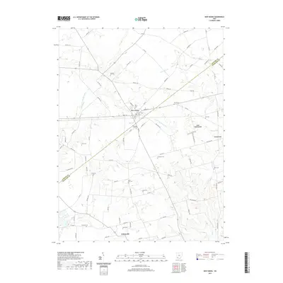
2019 Map of New Vienna
USGS Topo · Published 2019About this map
New Vienna serves as the primary hub of this landscape at the intersection of Clinton and Highland counties. The area is defined by its agricultural character and a remarkably dense distribution of family and community burial grounds, reflecting generations of rural settlement. Notable among these is the Gist Settlement and its associated Gist Cem, a site of significant local heritage.
Find a feature on this map
82 named features on this map. Tap any name to fly to it.
Don’t see what you’re looking for? This feature index may not catch every label — zoom into the map to look around manually.
Map Details
Editions of this 2019 New Vienna Map
This is the sole edition of this map. No revisions or reprints were ever made.
Other maps of this area

1907 · Blanchester
USGS Topo · 1:62,500

1917 · Hillsboro
USGS Topo · 1:62,500

1917 · Sabina
USGS Topo · 1:62,500

1917 · Sardinia
USGS Topo · 1:62,500

1943 · Sabina
USGS Topo · 1:62,500

1944 · Hillsboro
USGS Topo · 1:62,500

1944 · Sardinia
USGS Topo · 1:62,500

1947 · Columbus
USGS Topo · 1:250,000
1960 · Lynchburg
USGS Topo · 1:24,000

1960 · Martinsville
USGS Topo · 1:24,000