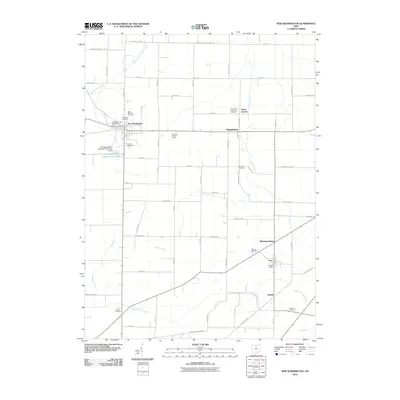
2010 Map of New Washington
USGS Topo · Published 2010About this map
New Washington and Tiro anchor this rural landscape in Crawford County, where the agricultural grid is interrupted by a network of significant waterways. The map documents the branching headwaters of Honey Creek, Broken Sword Creek, and Brokenknife Creek, which dictate the placement of local infrastructure like the New Washington Upground Reservoir Dam. This 2010 survey provides a meticulous record of the region’s spiritual and civic foundations, identifying numerous burial sites that serve as primary genealogical markers, including Saint Bernard Cemetery, Lutheran Cemetery, and Our Mother of Sorrows Cemetery. Small crossroads settlements like North Auburn, Mechanicsburg, and Dekalb appear alongside local landmarks such as the Cranberry Hills Golf Course, illustrating the persistent small-town character of north-central Ohio at the start of the 21st century.
Find a feature on this map
71 named features on this map. Tap any name to fly to it.
Don’t see what you’re looking for? This feature index may not catch every label — zoom into the map to look around manually.
Map Details
Editions of this 2010 New Washington Map
This is the sole edition of this map. No revisions or reprints were ever made.
Other maps of this area

1915 · Norwalk
USGS Topo · 1:62,500

1915 · Siam
USGS Topo · 1:62,500

1915 · Bucyrus
USGS Topo · 1:62,500

1915 · Crestline
USGS Topo · 1:62,500

1943 · Bucyrus
USGS Topo · 1:62,500

1943 · Crestline
USGS Topo · 1:62,500

1944 · Norwalk
USGS Topo · 1:62,500

1950 · Marion
USGS Topo · 1:250,000

1956 · Toledo
USGS Topo · 1:250,000

1960 · North Robinson
USGS Topo · 1:24,000