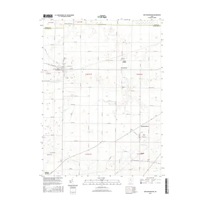
2016 Map of New Washington
USGS Topo · Published 2016About this map
New Washington sits at the heart of this North Central Ohio landscape, where the headwaters of several notable waterways begin their descent. The New Washington Upground Reservoir stands as a significant local feature just south of the main settlement, reflecting modern water management in a region defined by its agricultural grid. Waterways like Broken Sword Cr, Honey Cr, and Red Run carve subtle paths through the terrain, while the northern border is marked by the county lines of Seneca and Huron.
Find a feature on this map
50 named features on this map. Tap any name to fly to it.
Don’t see what you’re looking for? This feature index may not catch every label — zoom into the map to look around manually.
Map Details
Editions of this 2016 New Washington Map
This is the sole edition of this map. No revisions or reprints were ever made.
Other maps of this area

1915 · Norwalk
USGS Topo · 1:62,500

1915 · Siam
USGS Topo · 1:62,500

1915 · Bucyrus
USGS Topo · 1:62,500

1915 · Crestline
USGS Topo · 1:62,500

1943 · Bucyrus
USGS Topo · 1:62,500

1943 · Crestline
USGS Topo · 1:62,500

1944 · Norwalk
USGS Topo · 1:62,500

1950 · Marion
USGS Topo · 1:250,000

1956 · Toledo
USGS Topo · 1:250,000

1960 · North Robinson
USGS Topo · 1:24,000