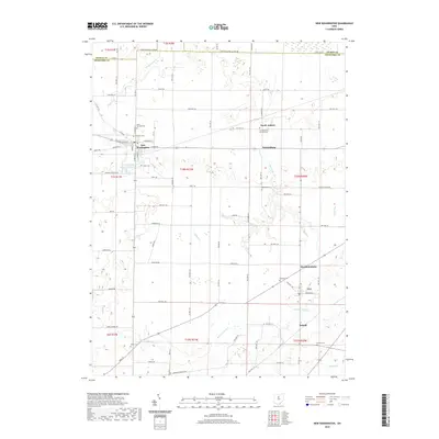
2019 Map of New Washington
USGS Topo · Published 2019About this map
The village of New Washington serves as the primary hub of this north-central Ohio landscape, where the Crawford, Seneca, and Huron county lines converge. The town layout is defined by the intersection of N Kibler St and E Main St, with a post office and several local religious landmarks, including Saint Bernard Cem and Lutheran Cem. To the south, the New Washington Upground Reservoir stands as a prominent engineered feature amidst the agricultural grid. The surrounding countryside is dotted with small hamlets such as North Auburn, Waynesburg, and Tiro, each maintaining its own identity through local cemeteries like Our Mother of Sorrows Cem and Oakland Cem. The drainage patterns of the region are shaped by the Broken Sword Cr and Honey Cr, which meander through the farmland, illustrating the persistent importance of water management in this rural township setting.
Find a feature on this map
96 named features on this map. Tap any name to fly to it.
Don’t see what you’re looking for? This feature index may not catch every label — zoom into the map to look around manually.
Map Details
Editions of this 2019 New Washington Map
This is the sole edition of this map. No revisions or reprints were ever made.
Other maps of this area

1915 · Norwalk
USGS Topo · 1:62,500

1915 · Siam
USGS Topo · 1:62,500

1915 · Bucyrus
USGS Topo · 1:62,500

1915 · Crestline
USGS Topo · 1:62,500

1943 · Bucyrus
USGS Topo · 1:62,500

1943 · Crestline
USGS Topo · 1:62,500

1944 · Norwalk
USGS Topo · 1:62,500

1950 · Marion
USGS Topo · 1:250,000

1956 · Toledo
USGS Topo · 1:250,000

1960 · North Robinson
USGS Topo · 1:24,000