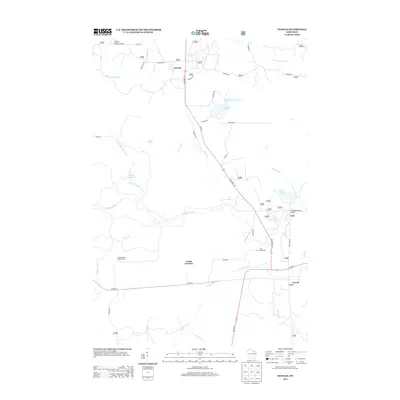
2013 Map of Newald
USGS Topo · Published 2013About this map
The forest and river systems of Forest County define this 2013 survey of the northern Wisconsin wilderness. At the northern edge of the map, the settlement of Newald sits at the junction of State Hwy 139 and Broadway St, while the community of Cavour occupies the southeastern corner where US Hwy 8 meets the regional road network. The central landscape is dominated by the winding path of the Peshtigo River and its numerous tributaries, including Kersten Cr and Camp Eight Cr. This area is historically significant for its rail-and-logging connections, noted here by Soo Xing and the Consolidated Lookout Tower. Smaller water bodies like Van Zile Lake and Marsh Number Ten dot the terrain, illustrating the glacial hydrography of the region. The map provides a clear record of remote access points like the Big Joe Campground, situated along the river's edge south of the main highway corridors.
Find a feature on this map
42 named features on this map. Tap any name to fly to it.
Don’t see what you’re looking for? This feature index may not catch every label — zoom into the map to look around manually.
Map Details
Editions of this 2013 Newald Map
This is the sole edition of this map. No revisions or reprints were ever made.
Other maps of this area

1938 · Alvin
USGS Topo · 1:48,000

1939 · Crandon
USGS Topo · 1:48,000

1939 · Laona
USGS Topo · 1:48,000

1939 · Long Lake
USGS Topo · 1:48,000

1941 · Crandon
USGS Topo · 1:48,000

1946 · Laona
USGS Topo · 1:48,000

1946 · Alvin
USGS Topo · 1:48,000

1947 · Crandon
USGS Topo · 1:48,000

1948 · Long Lake
USGS Topo · 1:48,000

1954 · Iron Mountain
USGS Topo · 1:250,000