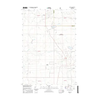
2015 Map of Newald
USGS Topo · Published 2015About this map
The Soo Line corridor defines the Northwoods geography of this 2015 survey, passing through the remote timberlands and wetland systems of Forest and Florence Counties. The settlement at Newald serves as a focal point in the northern portion of the quadrangle, while the historic rail-connected communities of Laona Junction and Cavour anchor the central and southeastern reaches. This area is characterized by an intricate network of waterways, including the winding Peshtigo River and the headwaters of the Little Popple River. Large portions of the terrain are preserved within the Nicolet National Forest, revealing a landscape of glacially-formed basins such as Van Zile Lake and Ross Lake. Small drainage features like Marsh Number Ten and Kersten Cr reflect the complex hydrology of the region, which has long supported the local logging and outdoor recreation economies.
Find a feature on this map
46 named features on this map. Tap any name to fly to it.
Don’t see what you’re looking for? This feature index may not catch every label — zoom into the map to look around manually.
Map Details
Editions of this 2015 Newald Map
This is the sole edition of this map. No revisions or reprints were ever made.
Other maps of this area

1938 · Alvin
USGS Topo · 1:48,000

1939 · Crandon
USGS Topo · 1:48,000

1939 · Laona
USGS Topo · 1:48,000

1939 · Long Lake
USGS Topo · 1:48,000

1941 · Crandon
USGS Topo · 1:48,000

1946 · Laona
USGS Topo · 1:48,000

1946 · Alvin
USGS Topo · 1:48,000

1947 · Crandon
USGS Topo · 1:48,000

1948 · Long Lake
USGS Topo · 1:48,000

1954 · Iron Mountain
USGS Topo · 1:250,000