2022 Map of Newald
USGS Topo · Published 2022About this map
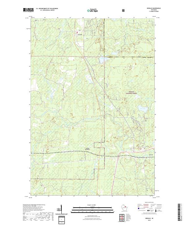
Newald and the surrounding woodlands of the Nicolet National Forest define this corner of Forest County, where the landscape is heavily shaped by glacial hydrology and historical transportation routes. The Peshtigo River meanders across the central terrain, complemented by several smaller waterways like Little Popple River and S Br Popple River. The settlement pattern follows the established rail-and-road corridors, with Laona Junction and Cavour serving as key points of reference. The latter is noted for the Cavour Cem located just west of the main cluster of buildings. The Nicolet State Trl cuts a prominent north-south path through the forest, tracing a route that once served the region's timber and rail economy. Away from the primary roads like Co HWY G, the map reveals a complex network of wetlands and small water bodies, including Van Zile Lake, Ross Lake, and the interestingly named Marsh Number Ten.
Find a feature on this map
37 named features on this map. Tap any name to fly to it.
Don’t see what you’re looking for? This feature index may not catch every label — zoom into the map to look around manually.
Map Details
Editions of this 2022 Newald Map
This is the sole edition of this map. No revisions or reprints were ever made.