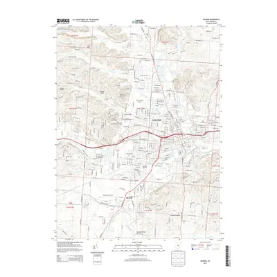
2013 Map of Newark
USGS Topo · Published 2013About this map
Newark and Heath sit at the confluence of several significant waterways, where the North Fork Licking River, South Fork Licking River, and Raccoon Creek converge to form the Licking River. The landscape is a mix of dense municipal development and specialized cultural sites, including the archaeological significance of the Newark Mounds. In the northwestern portion of the map, the Welsh Hills and Sharon Valley rise above the river plains, housing institutional centers like the Ohio State University-Newark Campus and Central Ohio Technical Coll. For genealogists, the sheet is particularly dense with burial grounds, ranging from large urban sites like Cedar Hill Cem and Mt Calvary Cem to smaller outliers such as Evans Cem, Wilson Cem, and Sanford Cem. The transportation infrastructure is anchored by the Newark-Heath Airport and a grid that transitions into the rural hills of Vanatta and Lloyd Corners.
Find a feature on this map
164 named features on this map. Tap any name to fly to it.
Don’t see what you’re looking for? This feature index may not catch every label — zoom into the map to look around manually.
Map Details
Editions of this 2013 Newark Map
This is the sole edition of this map. No revisions or reprints were ever made.
Other maps of this area

1907 · Thurston
USGS Topo · 1:62,500

1908 · Granville
USGS Topo · 1:62,500

1909 · Newark
USGS Topo · 1:62,500

1909 · Thornville
USGS Topo · 1:62,500

1909 · Thurston
USGS Topo · 1:62,500

1910 · Granville
USGS Topo · 1:62,500

1947 · Columbus
USGS Topo · 1:250,000

1950 · Marion
USGS Topo · 1:250,000

1961 · Columbus
USGS Topo · 1:250,000

1961 · Hanover
USGS Topo · 1:24,000