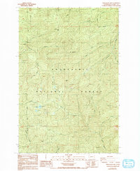
1987 Map of Newaukum Lake
USGS Topo · Published 1993About this map
Snoqualmie National Forest dominates this mountain landscape in Lewis County, where the headwaters of several major river systems diverge from high ridges. The area is defined by its topographic extremes, anchored by Bald Mtn, Huckleberry Mtn, and the distinctive Rooster Rock. At the heart of the terrain lies Newaukum Lake, feeding the South Fork Newaukum River. This 1980s survey illustrates a wilderness being utilized for its resources, evidenced by the numerous Borrow Pits and 4WD tracks scattered across the slopes. Water is the primary architect here, with the Skookumchuck River, West Fork Deschutes River, and North Fork Tilton River all drawing from these same heights. The network of drainage, from Thorn Creek to Jesse Creek, reveals the intricate watershed patterns that have long shaped the geography of southwestern Washington.
Find a feature on this map
31 named features on this map. Tap any name to fly to it.
Don’t see what you’re looking for? This feature index may not catch every label — zoom into the map to look around manually.
Map Details
Editions of this 1987 Newaukum Lake Map
2 editions found
Other maps of this area

1916 · Chehalis
USGS Topo · 1:125,000

1937 · Eatonville
USGS Topo · 1:125,000

1941 · Tanwax Lake
USGS Topo · 1:62,500

1943 · Willapa
USGS Topo · 1:62,500

1944 · Yelm
USGS Topo · 1:62,500

1944 · Ohop Valley
USGS Topo · 1:62,500

1949 · Ohop Valley
USGS Topo · 1:62,500

1949 · Yelm
USGS Topo · 1:62,500

1953 · Hoquiam
USGS Topo · 1:250,000

1954 · Onalaska
USGS Topo · 1:62,500