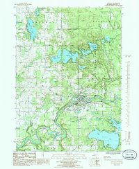
1985 Map of Newaygo
USGS Topo · Published 1985About this map
The Muskegon River winds through the heart of this landscape, anchoring the city of Newaygo at a point where the river bends sharply south. In the mid-1980s, this area reflects a balance of industrial infrastructure and recreation, with the C & O railroad line serving the river valley and Drew Siding to the northeast. To the south, the massive expanse of Hess Lake and the smaller Brooks Lake are centers of community activity, marked by landmarks like Brooks Lake Chapel and Faith Temple.
Find a feature on this map
58 named features on this map. Tap any name to fly to it.
Don’t see what you’re looking for? This feature index may not catch every label — zoom into the map to look around manually.
Map Details
Editions of this 1985 Newaygo Map
This is the sole edition of this map. No revisions or reprints were ever made.
Other maps of this area

1954 · Midland
USGS Topo · 1:250,000

1958 · Midland
USGS Topo · 1:250,000

1958 · Sand Lake
USGS Topo · 1:62,500

1958 · Fremont
USGS Topo · 1:62,500

1958 · Woodville
USGS Topo · 1:62,500

1959 · Midland
USGS Topo · 1:250,000

1959 · White Cloud
USGS Topo · 1:62,500

1966 · Midland
USGS Topo · 1:250,000
1976 · White Cloud SW
USGS Topo · 1:24,000

1976 · White Cloud SE
USGS Topo · 1:24,000