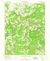
1960 Map of Newburg
USGS Topo · Published 1968About this map
Arthurdale, established as a New Deal subsistence homestead community, occupies the northern reaches of this Preston County landscape along Deckers Creek. The map documents a deeply industrialized terrain defined by the Baltimore and Ohio railroad corridor and the intensive extraction shown at Strip Mines and the Arthurdale Gem. Settlement patterns follow the winding path of Three Fork Creek, with nodes of local life found at Independence and Newburg.
Find a feature on this map
58 named features on this map. Tap any name to fly to it.
Don’t see what you’re looking for? This feature index may not catch every label — zoom into the map to look around manually.
Map Details
Editions of this 1960 Newburg Map
4 editions found
Other maps of this area

1886 · St. George
USGS Topo · 1:125,000

1891 · St. George
USGS Topo · 1:125,000

1902 · Morgantown
USGS Topo · 1:62,500

1904 · Bruceton
USGS Topo · 1:62,500

1907 · Thornton
USGS Topo · 1:62,500

1907 · Kingwood
USGS Topo · 1:62,500

1925 · Kingwood
USGS Topo · 1:62,500

1925 · Morgantown
USGS Topo · 1:62,500

1926 · Thornton
USGS Topo · 1:62,500

1926 · Bruceton
USGS Topo · 1:62,500