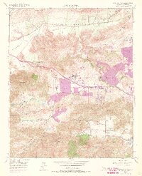
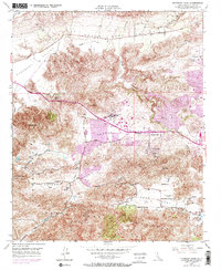
1950 Map of Newbury Park
USGS Topo · Published 1968About this map
Conejo Valley sits at the heart of this survey, which captures the region's mid-century transformation as residential footprints began to overlay the older ranching and agricultural landscape. The 1950 field check shows a sparsely developed corridor along Ventura Blvd, including the Newbury Park Academy and the rural Santa Rosa School. A notable 1967 revision, shown in purple, documents the rapid expansion of Newbury Park and the development of Mountclef Village, signaling the area's shift into a more suburban character. The landscape is defined by the surrounding heights of the Santa Monica Mountains and Mount Clef Ridge, with transportation and utility infrastructure like the Rancho Conejo Airport, a Drive-in Theater, and an Airway Beacon serving the growing community. In the southern reaches, Hidden Valley remains largely open, contrasting with the emerging lakeside settlement at Lake Sherwood.
Find a feature on this map
37 named features on this map. Tap any name to fly to it.
Don’t see what you’re looking for? This feature index may not catch every label — zoom into the map to look around manually.
Map Details
Editions of this 1950 Newbury Park Map
5 editions found
Other maps of this area

1900 · Triunfo Pass
USGS Topo · 1:62,500

1900 · Piru
USGS Topo · 1:62,500

1903 · Santa Paula
USGS Topo · 1:62,500

1903 · Camulos
USGS Topo · 1:125,000

1904 · Hueneme
USGS Topo · 1:62,500

1921 · Piru
USGS Topo · 1:62,500

1921 · Triunfo Pass
USGS Topo · 1:62,500

1932 · Russell Valley
USGS Topo · 1:24,000

1941 · Piru
USGS Topo · 1:62,500

1942 · Santa Paula
USGS Topo · 1:62,500