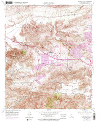
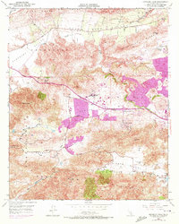
1950 Map of Newbury Park
USGS Topo · Published 1972About this map
El Conejo land grant history meets the mid-century development of Ventura County in this survey of the terrain between the Santa Monica Mountains and the Santa Rosa Valley. The landscape is defined by its dramatic topographic shifts, from the heights of Conejo Mtn and Mount Clef Ridge down to the agricultural and residential pockets of Conejo Valley. Notable local institutions like the Newbury Park Academy and Santa Rosa School serve these developing ranch and valley communities.
Find a feature on this map
39 named features on this map. Tap any name to fly to it.
Don’t see what you’re looking for? This feature index may not catch every label — zoom into the map to look around manually.
Map Details
Editions of this 1950 Newbury Park Map
5 editions found
Other maps of this area

1900 · Triunfo Pass
USGS Topo · 1:62,500

1900 · Piru
USGS Topo · 1:62,500

1903 · Santa Paula
USGS Topo · 1:62,500

1903 · Camulos
USGS Topo · 1:125,000

1904 · Hueneme
USGS Topo · 1:62,500

1921 · Piru
USGS Topo · 1:62,500

1921 · Triunfo Pass
USGS Topo · 1:62,500

1932 · Russell Valley
USGS Topo · 1:24,000

1941 · Piru
USGS Topo · 1:62,500

1942 · Santa Paula
USGS Topo · 1:62,500