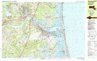
1985 Map of Newburyport
USGS Topo · Published 1985About this map
The Merrimack River dominates the center of this 1980s coastal landscape, serving as the historical and commercial artery for Newburyport and Amesbury. This period shows the transition of the waterfront from its maritime industrial roots toward conservation, with the extensive Parker River National Wildlife Refuge and Salisbury Beach State Reservation protecting large swaths of the Atlantic shoreline. Genealogists will find a wealth of data in the numerous burial sites, including the Sawyer Hill Burying Ground, St Marys Cem, and Old Town Cem in Newbury Old Town. The map also captures educational and navigational landmarks such as the Governor Dummer Academy and the Newburyport Light near Joppa Flats. The presence of the Boston and Maine rail line and the USCG Station illustrates the area's continued role as a transportation and safety hub for the North Shore.
Find a feature on this map
97 named features on this map. Tap any name to fly to it.
Don’t see what you’re looking for? This feature index may not catch every label — zoom into the map to look around manually.
Map Details
Editions of this 1985 Newburyport Map
This is the sole edition of this map. No revisions or reprints were ever made.
Other maps of this area

1886 · Gloucester
USGS Topo · 1:62,500

1886 · Lawrence
USGS Topo · 1:62,500

1888 · Newburyport
USGS Topo · 1:62,500

1888 · Haverhill
USGS Topo · 1:62,500

1888 · Gloucester
USGS Topo · 1:62,500

1888 · Lawrence
USGS Topo · 1:62,500

1888 · Salem
USGS Topo · 1:62,500

1890 · Haverhill
USGS Topo · 1:62,500

1890 · Newburyport
USGS Topo · 1:62,500

1893 · Salem
USGS Topo · 1:62,500