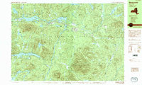
1989 Map of Newcomb
USGS Topo · Published 1989About this map
Newcomb serves as the primary gateway to this high-elevation landscape within the Adirondack Park in the late 1980s. The settlement pattern is concentrated near the shores of Harris Lake and along the 28n corridor, while the Tahawus Club and Winebrook Hills mark established residential and social pockets amidst the forest. The terrain is defined by massive peaks including Goodnow Mountain and Vanderwhacker Mountain, creating a complex drainage network that feeds into the Boreas River and the Newcomb River.
Find a feature on this map
67 named features on this map. Tap any name to fly to it.
Don’t see what you’re looking for? This feature index may not catch every label — zoom into the map to look around manually.
Map Details
Editions of this 1989 Newcomb Map
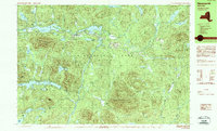
2 editions found
Other maps of this area

1895 · Mt. Marcy
USGS Topo · 1:62,500

1897 · Schroon Lake
USGS Topo · 1:62,500

1898 · Newcomb
USGS Topo · 1:62,500

1901 · Newcomb
USGS Topo · 1:62,500

1902 · Mt. Marcy
USGS Topo · 1:62,500

1903 · Blue Mountain
USGS Topo · 1:62,500

1904 · Santanoni
USGS Topo · 1:62,500

1904 · Long Lake
USGS Topo · 1:62,500

1948 · Ogdensburg
USGS Topo · 1:250,000

1950 · Glens Falls
USGS Topo · 1:250,000