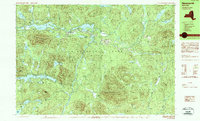
1989 Map of Newcomb
USGS Topo · Published 1989About this map
Newcomb is situated at the heart of this late-20th-century landscape, positioned between the expansive waters of Rich Lake and Harris Lake. This high-altitude region of the Adirondack Park is defined by its complex hydrology and massive peaks, with the Hudson River winding through the eastern portion of the sheet. The presence of the SUNY Newcomb Campus and the Tahawus Club indicates the area's dual identity as a center for scientific research and private recreation.
Find a feature on this map
71 named features on this map. Tap any name to fly to it.
Don’t see what you’re looking for? This feature index may not catch every label — zoom into the map to look around manually.
Map Details
Editions of this 1989 Newcomb Map
2 editions found
Other maps of this area

1895 · Mt. Marcy
USGS Topo · 1:62,500

1897 · Schroon Lake
USGS Topo · 1:62,500

1898 · Newcomb
USGS Topo · 1:62,500

1901 · Newcomb
USGS Topo · 1:62,500

1902 · Mt. Marcy
USGS Topo · 1:62,500

1903 · Blue Mountain
USGS Topo · 1:62,500

1904 · Santanoni
USGS Topo · 1:62,500

1904 · Long Lake
USGS Topo · 1:62,500

1948 · Ogdensburg
USGS Topo · 1:250,000

1950 · Glens Falls
USGS Topo · 1:250,000