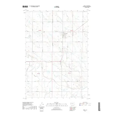
2017 Map of Newell
USGS Topo · Published 2017About this map
The Belle Fourche River meanders through this agricultural landscape in Butte County, defining a complex network of water management features essential to the region's development. Centered on the town of Newell, the map reveals an extensive system of irrigation canals and ditches, including the N Canal, S Canal, and Long Canal, alongside numerous laterals such as the Town Site Lateral and Deadman Lateral. These man-made watercourses follow the local topography, often intersecting natural drainages like Horse Cr and Deadman Cr.
Find a feature on this map
56 named features on this map. Tap any name to fly to it.
Don’t see what you’re looking for? This feature index may not catch every label — zoom into the map to look around manually.
Map Details
Editions of this 2017 Newell Map
This is the sole edition of this map. No revisions or reprints were ever made.
Other maps of this area

1905 · Saint Onge
USGS Topo · 1:62,500

1906 · Two Top
USGS Topo · 1:62,500

1906 · Vale
USGS Topo · 1:62,500

1907 · Belle Fourche
USGS Topo · 1:125,000

1913 · Newell
USGS Topo · 1:125,000

1951 · Vale
USGS Topo · 1:24,000

1951 · Vale SE
USGS Topo · 1:24,000

1951 · Newell
USGS Topo · 1:24,000

1951 · Vale NE
USGS Topo · 1:24,000
1951 · Nisland
USGS Topo · 1:24,000