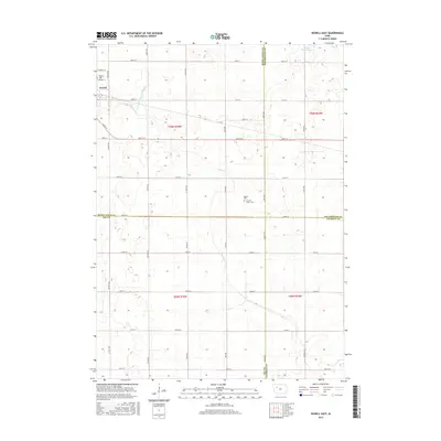
2015 Map of Newell East
USGS Topo · Published 2015About this map
Newell sits at the western edge of this 2015 survey, serving as the primary hub for a landscape defined by industrial-scale agriculture and a sophisticated water management network. The terrain is marked by the meandering Prairie Cr and the engineered precision of Drainage Ditch Number 20, reflecting over a century of land reclamation in the region. For genealogists and local historians, the map is particularly valuable for its documentation of three distinct burial sites: Newell Cem, the Cooke Cem, and the First M E Church Cem. The map also illustrates the convergence of four Iowa counties—Buena Vista, Pocahontas, Sac, and Calhoun—emphasizing the area's significance as a rural crossroads. Notable natural landmarks like Sunken Island Lake in the northeast corner provide a contrast to the geometric grid of county roads and township boundaries.
Find a feature on this map
43 named features on this map. Tap any name to fly to it.
Don’t see what you’re looking for? This feature index may not catch every label — zoom into the map to look around manually.
Map Details
Editions of this 2015 Newell East Map
This is the sole edition of this map. No revisions or reprints were ever made.
Other maps of this area

1954 · Fort Dodge
USGS Topo · 1:250,000

1957 · Fort Dodge
USGS Topo · 1:250,000

1958 · Fort Dodge
USGS Topo · 1:250,000

1979 · Varina
USGS Topo · 1:24,000

1979 · Fonda
USGS Topo · 1:24,000

1979 · Newell West
USGS Topo · 1:24,000

1979 · Storm Lake NE
USGS Topo · 1:24,000

1979 · Newell East
USGS Topo · 1:24,000

1979 · Fonda NE
USGS Topo · 1:24,000

1980 · Lytton
USGS Topo · 1:24,000