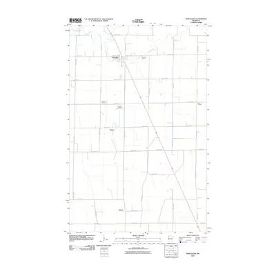
2010 Map of Newfolden
USGS Topo · Published 2010About this map
Newfolden sits along the winding course of the Middle River, serving as a central hub for the surrounding Marshall County agricultural landscape. The township is characterized by a precise grid of section roads, including Center Ave N and several numbered thoroughfares like 330th St NW. This 2010 survey highlights a significant density of burial grounds that reflect the area's pioneer heritage and family lineages, including the Augustana Cemetery and Westaker Cemetery. Further south, the rural landscape is marked by the Sorenson Cemetery and Bjorsness Cemetery, while the Bethlehem Cemetery and Folden Cemetery anchor the southern and eastern reaches of the quadrangle. The map captures the organized layout of a modern farming community where the natural hydrology of the river intersects with a deeply established network of local infrastructure.
Find a feature on this map
28 named features on this map. Tap any name to fly to it.
Don’t see what you’re looking for? This feature index may not catch every label — zoom into the map to look around manually.
Map Details
Editions of this 2010 Newfolden Map
This is the sole edition of this map. No revisions or reprints were ever made.
Other maps of this area

1918 · Viking
USGS Topo · 1:62,500

1918 · Middle River
USGS Topo · 1:62,500

1943 · Thief River Falls
USGS Topo · 1:62,500

1952 · Thief River Falls
USGS Topo · 1:250,000

1956 · Thief River Falls
USGS Topo · 1:250,000

1957 · Thief River Falls
USGS Topo · 1:250,000

1957 · Newfolden
USGS Topo · 1:62,500

1959 · Viking
USGS Topo · 1:24,000

1959 · Rosewood
USGS Topo · 1:24,000
1961 · Thief River Falls NW
USGS Topo · 1:24,000