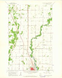
1961 Map of Thief River Falls NW
USGS Topo · Published 1963About this map
Thief River meanders through the heart of this early 1960s landscape, serving as the central geographic feature for the growing city of Thief River Falls. The settlement pattern reflects a strong reliance on transportation corridors, with the Great Northern and Soo Line railroads converging near Dakota Junction. This rail junction is a significant focal point for local history, illustrating the region's importance as a transit hub. The map shows the interplay between the natural river path and the Old Thief River oxbows, alongside rural landmarks like the Steiner Community Hall. Local institutions such as the St Bernard Cem and Northrop Sch provide valuable detail for genealogists tracking family ties in the townships of Excel, Solum, and Norden. Industrial activity is noted by several Gravel Pits dotting the western sections, while the city's modern infrastructure is represented by the Radio Tower (KTRF).
Find a feature on this map
18 named features on this map. Tap any name to fly to it.
Don’t see what you’re looking for? This feature index may not catch every label — zoom into the map to look around manually.
Map Details
Editions of this 1961 Thief River Falls NW Map
2 editions found
Other maps of this area

1918 · Viking
USGS Topo · 1:62,500

1918 · Middle River
USGS Topo · 1:62,500

1943 · Thief River Falls
USGS Topo · 1:62,500

1952 · Thief River Falls
USGS Topo · 1:250,000

1956 · Thief River Falls
USGS Topo · 1:250,000

1957 · Thief River Falls
USGS Topo · 1:250,000

1957 · Newfolden
USGS Topo · 1:62,500

1959 · Rosewood
USGS Topo · 1:24,000
1959 · Thief River Falls
USGS Topo · 1:24,000
1959 · Viking SE
USGS Topo · 1:24,000