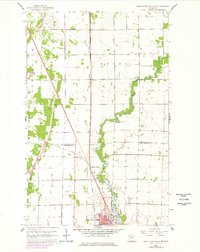
1961 Map of Thief River Falls NW
USGS Topo · Published 1977About this map
Thief River meanders through the heart of this northwestern Minnesota landscape, marking the border between the townships of Excel and North. This 1961 topographic survey captures the rural infrastructure surrounding the northern outskirts of Thief River Falls, where the city limits begin to expand near St Bernard Cem and the Northrop Sch. The map reveals a highly managed hydrological system, where the natural winding river is supplemented by extensive engineering projects like Judicial Ditch No 14 and County Ditch No 70.
Find a feature on this map
19 named features on this map. Tap any name to fly to it.
Don’t see what you’re looking for? This feature index may not catch every label — zoom into the map to look around manually.
Map Details
Editions of this 1961 Thief River Falls NW Map
2 editions found
Other maps of this area

1918 · Viking
USGS Topo · 1:62,500

1918 · Middle River
USGS Topo · 1:62,500

1943 · Thief River Falls
USGS Topo · 1:62,500

1952 · Thief River Falls
USGS Topo · 1:250,000

1956 · Thief River Falls
USGS Topo · 1:250,000

1957 · Thief River Falls
USGS Topo · 1:250,000

1957 · Newfolden
USGS Topo · 1:62,500

1959 · Rosewood
USGS Topo · 1:24,000
1959 · Thief River Falls
USGS Topo · 1:24,000
1959 · Viking SE
USGS Topo · 1:24,000