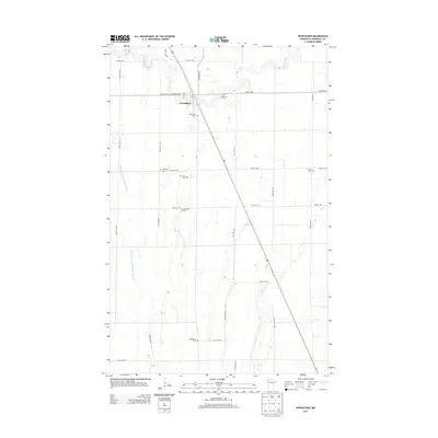
2013 Map of Newfolden
USGS Topo · Published 2013About this map
Newfolden sits as the central hub of this Marshall County landscape, where the winding path of the Middle River meets a strictly organized grid of agricultural section lines. This 2013 survey illustrates a rural Minnesota community defined by its proximity to water and its commitment to local heritage, evidenced by the high density of small family and community burial grounds scattered across the prairie. The engineering of the landscape is further emphasized by the presence of the Main Judicial Ditch Number Fifteen, which cuts across the western portion of the quadrangle to manage drainage in this level terrain. Genealogists and local historians will find significant value in the distribution of these cemeteries, from Augustana Cem and Oak Grove Cem near the town center to more outlying sites like Folden Cem and Bethlehem Cem, which mark the early footprints of rural settlement and church congregations in the region.
Find a feature on this map
30 named features on this map. Tap any name to fly to it.
Don’t see what you’re looking for? This feature index may not catch every label — zoom into the map to look around manually.
Map Details
Editions of this 2013 Newfolden Map
This is the sole edition of this map. No revisions or reprints were ever made.
Other maps of this area

1918 · Viking
USGS Topo · 1:62,500

1918 · Middle River
USGS Topo · 1:62,500

1943 · Thief River Falls
USGS Topo · 1:62,500

1952 · Thief River Falls
USGS Topo · 1:250,000

1956 · Thief River Falls
USGS Topo · 1:250,000

1957 · Thief River Falls
USGS Topo · 1:250,000

1957 · Newfolden
USGS Topo · 1:62,500

1959 · Viking
USGS Topo · 1:24,000

1959 · Rosewood
USGS Topo · 1:24,000
1961 · Thief River Falls NW
USGS Topo · 1:24,000