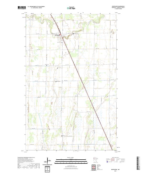
2022 Map of Newfolden
USGS Topo · Published 2022About this map
Newfolden serves as the central hub of this Marshall County landscape, where the town's grid meets the steel of Railroad St N. The surrounding countryside is defined by the winding course of the Middle River to the north and the engineered precision of the Main Judicial Ditch Number Fifteen to the south, reflecting a long history of water management in this agricultural region. Genealogists will find a high concentration of local history preserved in the numerous family and community burial grounds dotting the townships, including Augustana Cem, Oak Grove Cem, and Sorenson Cem. These sites, along with Westaker Cem and Björsness Cem, mark the legacy of the area's early settlers and their ties to the prairie soil. The map provides a clear look at the rural road network, from Co Hwy 28 to the grid-straight stretches of 320th St NW, showing how transportation evolved around the river and rail lines.
Find a feature on this map
32 named features on this map. Tap any name to fly to it.
Don’t see what you’re looking for? This feature index may not catch every label — zoom into the map to look around manually.
Map Details
Editions of this 2022 Newfolden Map
This is the sole edition of this map. No revisions or reprints were ever made.
Other maps of this area

1918 · Viking
USGS Topo · 1:62,500

1918 · Middle River
USGS Topo · 1:62,500

1943 · Thief River Falls
USGS Topo · 1:62,500

1952 · Thief River Falls
USGS Topo · 1:250,000

1956 · Thief River Falls
USGS Topo · 1:250,000

1957 · Thief River Falls
USGS Topo · 1:250,000

1957 · Newfolden
USGS Topo · 1:62,500

1959 · Viking
USGS Topo · 1:24,000

1959 · Rosewood
USGS Topo · 1:24,000
1961 · Thief River Falls NW
USGS Topo · 1:24,000