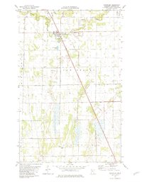
1982 Map of Newfolden
USGS Topo · Published 1982About this map
Newfolden serves as the central hub of this Marshall County survey, situated at the intersection of the Soo Line railroad and the meandering Middle River. The landscape reflects a deeply managed agricultural environment, defined by an extensive network of drainage infrastructure such as Judicial Ditch No 21 and County Ditch No 15. These channels reveal the concerted effort to transform the Spruce Valley region into productive farmland during the late 20th century.
Find a feature on this map
24 named features on this map. Tap any name to fly to it.
Don’t see what you’re looking for? This feature index may not catch every label — zoom into the map to look around manually.
Map Details
Editions of this 1982 Newfolden Map
This is the sole edition of this map. No revisions or reprints were ever made.
Other maps of this area

1918 · Viking
USGS Topo · 1:62,500

1918 · Middle River
USGS Topo · 1:62,500

1943 · Thief River Falls
USGS Topo · 1:62,500

1952 · Thief River Falls
USGS Topo · 1:250,000

1956 · Thief River Falls
USGS Topo · 1:250,000

1957 · Thief River Falls
USGS Topo · 1:250,000

1957 · Newfolden
USGS Topo · 1:62,500

1959 · Viking
USGS Topo · 1:24,000

1959 · Rosewood
USGS Topo · 1:24,000
1961 · Thief River Falls NW
USGS Topo · 1:24,000