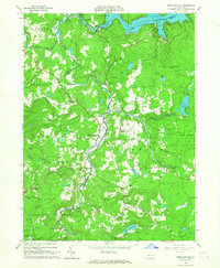
1966 Map of Newfoundland
USGS Topo · Published 1967About this map
Newfoundland serves as the central hub of this 1960s Pocono plateau landscape, situated at the confluence of several mountain streams. The settlement pattern follows the winding course of Wallenpaupack Creek, where smaller communities like Greentown and Hemlock Grove are tucked into the valleys. Local industry and agriculture are visible through several Gravel Pits and the presence of Haags Mill on the southern reaches of the creek. Genealogists will find notable local landmarks including the Pine Grove Cem near South Sterling and churches such as St Mary Magdalen Ch and Zion Ch. To the north, the waters of Lake Wallenpaupack dominate the boundary between Wayne and Pike counties, while the eastern portion of the map is largely occupied by dense State Forest, punctuated only by isolated water bodies like Lake Paupack and Pine Lake.
Find a feature on this map
44 named features on this map. Tap any name to fly to it.
Don’t see what you’re looking for? This feature index may not catch every label — zoom into the map to look around manually.
Map Details
Editions of this 1966 Newfoundland Map
3 editions found
Other maps of this area

1919 · Pocono
USGS Topo · 1:62,500

1921 · Pocono
USGS Topo · 1:62,500

1923 · Pocono
USGS Topo · 1:62,500

1924 · Bushkill
USGS Topo · 1:48,000

1928 · Ariel
USGS Topo · 1:62,500

1932 · Ariel
USGS Topo · 1:62,500

1935 · Hawley
USGS Topo · 1:62,500

1938 · Hawley
USGS Topo · 1:62,500

1943 · Bushkill
USGS Topo · 1:62,500

1943 · Pocono
USGS Topo · 1:62,500
Featured Places
- Sterling Township, PA
- Greene Township, PA
- Dreher Township, PA
- Greentown, Greene Township
- Lake in the Clouds, Greene Township