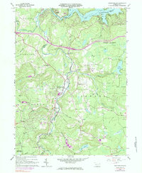
1966 Map of Newfoundland
USGS Topo · Published 1984About this map
Wallenpaupack Creek and its many tributaries, including Butternut Creek and Sugar Hill Creek, carve through this landscape at the border of Wayne and Pike counties. The map documents a cluster of settlements that grew around water power and timber, such as Haags Mill and Newfoundland. Local faith and community life are anchored by St Mary Magdalen Ch and Zion Ch, while Pine Grove Cem provides a focal point for genealogical research.
Find a feature on this map
49 named features on this map. Tap any name to fly to it.
Don’t see what you’re looking for? This feature index may not catch every label — zoom into the map to look around manually.
Map Details
Editions of this 1966 Newfoundland Map
3 editions found
Other maps of this area

1919 · Pocono
USGS Topo · 1:62,500

1921 · Pocono
USGS Topo · 1:62,500

1923 · Pocono
USGS Topo · 1:62,500

1924 · Bushkill
USGS Topo · 1:48,000

1928 · Ariel
USGS Topo · 1:62,500

1932 · Ariel
USGS Topo · 1:62,500

1935 · Hawley
USGS Topo · 1:62,500

1938 · Hawley
USGS Topo · 1:62,500

1943 · Bushkill
USGS Topo · 1:62,500

1943 · Pocono
USGS Topo · 1:62,500
Featured Places
- Sterling Township, PA
- Greene Township, PA
- Dreher Township, PA
- Greentown, Greene Township
- Lake in the Clouds, Greene Township