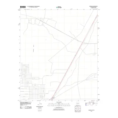
2010 Map of Newman
USGS Topo · Published 2010About this map
Newman sits directly on the interstate border in this early 21st-century survey of the Tularosa Valley. The landscape is defined by the sharp transition from the wide, open terrain of the desert to the grid of residential development emerging along the southern edge. A complex network of local streets, including Angelina Blvd and Broadmoor Dr, marks a growing community where personal family names appear on road labels like Jennifer Nicole Dr and David Michael Dr. To the north and east, the infrastructure shifts toward the military and logistical needs of the region, anchored by Mcgregor Range Rd and the long, diagonal stretch of Landing Strip Rd. This map captures the precise moment when suburban expansion meets the expansive utility of the high desert along State Line Dr.
Find a feature on this map
32 named features on this map. Tap any name to fly to it.
Don’t see what you’re looking for? This feature index may not catch every label — zoom into the map to look around manually.
Map Details
Editions of this 2010 Newman Map
This is the sole edition of this map. No revisions or reprints were ever made.
Other maps of this area

1896 · El Paso
USGS Topo · 1:125,000

1908 · El Paso
USGS Topo · 1:125,000

1939 · Heuco Tanks
USGS Topo · 1:62,500

1940 · Heuco Tanks
USGS Topo · 1:62,500

1940 · Newman
USGS Topo · 1:62,500

1941 · Desert
USGS Topo · 1:62,500

1942 · Fort Bliss
USGS Topo · 1:62,500

1943 · Desert
USGS Topo · 1:62,500

1943 · Newman
USGS Topo · 1:62,500

1944 · Heuco Tanks
USGS Topo · 1:62,500