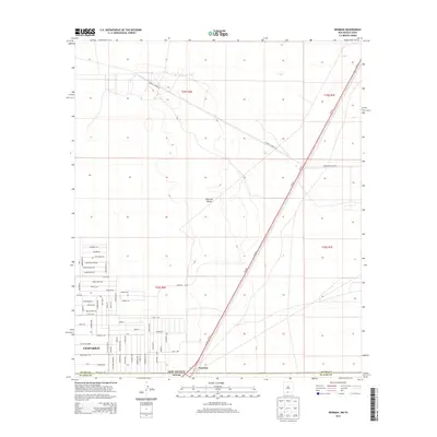
2013 Map of Newman
USGS Topo · Published 2013About this map
The desert landscape of the Tularosa Valley straddles the border between New Mexico and Texas, centered on the growing community of Chaparral. This 2013 survey illustrates the dense residential grid expanding into the arid terrain, with numerous named streets such as Alice Marie Dr, Mesilla Dr, and Indian Ruins Rd marking the local development. To the east, the settlement of Newman sits near the state line, while the dual lanes of Us-54 S and Us-54 N provide the primary transit corridor through the region. The map also reveals the area's logistical and military footprint through features like Landing Stripin Rd and its proximity to the Mcgregor Range Rd, showing how transportation and government land use have shaped this borderland environment.
Find a feature on this map
69 named features on this map. Tap any name to fly to it.
Don’t see what you’re looking for? This feature index may not catch every label — zoom into the map to look around manually.
Map Details
Editions of this 2013 Newman Map
This is the sole edition of this map. No revisions or reprints were ever made.
Other maps of this area

1896 · El Paso
USGS Topo · 1:125,000

1908 · El Paso
USGS Topo · 1:125,000

1939 · Heuco Tanks
USGS Topo · 1:62,500

1940 · Heuco Tanks
USGS Topo · 1:62,500

1940 · Newman
USGS Topo · 1:62,500

1941 · Desert
USGS Topo · 1:62,500

1942 · Fort Bliss
USGS Topo · 1:62,500

1943 · Desert
USGS Topo · 1:62,500

1943 · Newman
USGS Topo · 1:62,500

1944 · Heuco Tanks
USGS Topo · 1:62,500