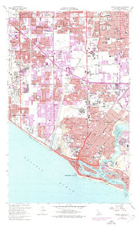
1965 Map of Newport Beach
USGS Topo · Published 1975About this map
The Santa Ana River flows through a landscape transitioning into a dense suburban corridor in this mid-1960s survey, with extensive purple revision tinting showing the rapid expansion of Fountain Valley and Costa Mesa by the early 1970s. The coastline is defined by the intricate geography of Newport Bay, featuring developed landmarks like Lido Isle, Balboa Island, and Linda Isle alongside the more natural reaches of Upper Newport Bay. To the northwest, an active Oil Field remains visible near Huntington Beach, contrasting with the burgeoning residential tracts and numerous civic institutions, including the Fairview State Hospital and Orange Coast College. Notable historical settlements such as Smeltzer, Wintersburg, and Ocean View are documented as they integrate into the growing grid of Orange County, while the Southern Pacific tracks and the emerging San Diego Freeway corridor illustrate the region's evolving transportation network.
Find a feature on this map
89 named features on this map. Tap any name to fly to it.
Don’t see what you’re looking for? This feature index may not catch every label — zoom into the map to look around manually.
Map Details
Editions of this 1965 Newport Beach Map
4 editions found
Other maps of this area

1896 · Santa Ana
USGS Topo · 1:62,500

1896 · Anaheim
USGS Topo · 1:62,500

1896 · Las Bolsas
USGS Topo · 1:62,500

1896 · Downey
USGS Topo · 1:62,500

1898 · Anaheim
USGS Topo · 1:62,500

1899 · Downey
USGS Topo · 1:62,500

1901 · Southern California Sheet No. 1
USGS Topo · 1:250,000

1901 · Santa Ana
USGS Topo · 1:62,500

1901 · Anaheim
USGS Topo · 1:62,500

1902 · Downey
USGS Topo · 1:62,500