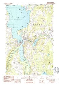
1986 Map of Newport
USGS Topo · Published 1987About this map
The international border between Canada and the United States defines the northern reaches of this map, where the village of Beebe Plain straddles the line. Centered on the southern tip of Lake Memphremagog, the city of Newport serves as a hub for the region's transport and commerce, featuring the Municipal Airport and the navigational Newport Stake Light. The landscape transitions from the developed waterfronts and the Golf Course to the protected wetlands of the South Bay State Wildlife Management Area.
Find a feature on this map
52 named features on this map. Tap any name to fly to it.
Don’t see what you’re looking for? This feature index may not catch every label — zoom into the map to look around manually.
Map Details
Editions of this 1986 Newport Map
2 editions found
Other maps of this area

1919 · Lake Memphremagog
USGS Topo · 1:62,500

1920 · Derby
USGS Topo · 1:62,500

1920 · Irasburg
USGS Topo · 1:62,500

1923 · Irasburg
USGS Topo · 1:48,000

1923 · Lake Memphremagog
USGS Topo · 1:48,000

1925 · Irasburg
USGS Topo · 1:62,500

1925 · Memphremagog
USGS Topo · 1:62,500

1950 · Lake Champlain
USGS Topo · 1:250,000

1953 · Irasburg
USGS Topo · 1:62,500
1953 · Memphremagog
USGS Topo · 1:62,500