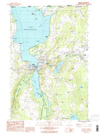
1986 Map of Newport
USGS Topo · Published 1987About this map
The international boundary between Canada and the United States defines the northern reaches of this Orleans County landscape, where the waters of Lake Memphremagog meet the Vermont shoreline. The city of Newport sits at the convergence of South Bay and the lake, serving as a focal point for regional activity. Further east, the Clyde River flows through Clyde Pond, past Derby Center and the rising slopes of Shattuck Hill. This mid-1980s survey captures a geography transitioning from the commercial center of Newport to the quiet, rolling hills of Brownington and North Derby. Land use is reflected in features like the Municipal Airport near Coventry and the extensive Black State South Bay Wildlife Management Area, which preserves the wetland ecosystems south of the main lake body. Small settlements like Beebe Plain sit directly on the border, illustrating the close historical ties between neighboring Quebec and Vermont communities.
Find a feature on this map
45 named features on this map. Tap any name to fly to it.
Don’t see what you’re looking for? This feature index may not catch every label — zoom into the map to look around manually.
Map Details
Editions of this 1986 Newport Map
2 editions found
Other maps of this area

1919 · Lake Memphremagog
USGS Topo · 1:62,500

1920 · Derby
USGS Topo · 1:62,500

1920 · Irasburg
USGS Topo · 1:62,500

1923 · Irasburg
USGS Topo · 1:48,000

1923 · Lake Memphremagog
USGS Topo · 1:48,000

1925 · Irasburg
USGS Topo · 1:62,500

1925 · Memphremagog
USGS Topo · 1:62,500

1950 · Lake Champlain
USGS Topo · 1:250,000

1953 · Irasburg
USGS Topo · 1:62,500
1953 · Memphremagog
USGS Topo · 1:62,500