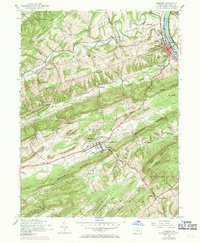
1952 Map of Newport
USGS Topo · Published 1969About this map
The Juniata River and the Penn Central rail line define the eastern edge of this mid-century Perry County landscape, where the ridges of the Appalachian Mountains run in parallel waves across the terrain. New Bloomfield serves as a primary hub of settlement, anchored by the Carson Long Institute and various civic services. The map reveals a transition from the industrial legacy of Juniata Furnace to a rural economy marked by a dense network of one-room schoolhouses like Laurel Grove School, Jericho School, and Centre School. These small institutions, along with hamlets like Markelsville and Wila, illustrate the decentralized community structure of the Pennsylvania interior before modern school consolidation and highway expansion. The varied topography, from Mahanoy Ridge to the Buffalo Creek valley, dictated the placement of early roads and small settlements throughout the townships of Juniata and Wheatfield.
Find a feature on this map
50 named features on this map. Tap any name to fly to it.
Don’t see what you’re looking for? This feature index may not catch every label — zoom into the map to look around manually.
Map Details
Editions of this 1952 Newport Map
4 editions found
Other maps of this area

1907 · New Bloomfield
USGS Topo · 1:62,500

1907 · Millerstown
USGS Topo · 1:62,500

1925 · Mifflintown
USGS Topo · 1:48,000

1930 · Loysville
USGS Topo · 1:62,500

1933 · Loysville
USGS Topo · 1:62,500

1934 · Mifflintown
USGS Topo · 1:62,500

1937 · Mifflintown
USGS Topo · 1:62,500

1943 · Millerstown
USGS Topo · 1:62,500

1943 · New Bloomfield
USGS Topo · 1:62,500

1950 · Harrisburg
USGS Topo · 1:250,000