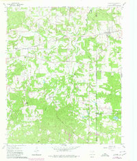
1960 Map of Newsome
USGS Topo · Published 1980About this map
The Newsome Oil Field anchors the northeast corner of this Wood County landscape, where the infrastructure of the Louisiana Arkansas and Texas railroad cuts through the terrain. The map reveals a high concentration of rural spiritual and community life, with numerous landmarks such as Morris Chapel, Smyrna Ch, and Hepsibah Baptist Ch serving the surrounding countryside. Several family and community burial grounds, including Monday Cem and Coldwater Cem, provide essential data points for local genealogists. The topography is defined by the winding paths of South Fork Brushy Creek and Lilly Creek, with small settlements like Scroggins and Westbrook dotting the road network. This survey reflects the mid-century intersection of the East Texas oil industry and established agricultural communities, captured just before later 20th-century developments altered the local character.
Find a feature on this map
43 named features on this map. Tap any name to fly to it.
Don’t see what you’re looking for? This feature index may not catch every label — zoom into the map to look around manually.
Map Details
Editions of this 1960 Newsome Map
3 editions found
Other maps of this area

1953 · Texarkana
USGS Topo · 1:250,000

1956 · Texarkana
USGS Topo · 1:250,000

1956 · Tyler
USGS Topo · 1:250,000

1960 · Winnsboro
USGS Topo · 1:24,000

1960 · Cartwright
USGS Topo · 1:24,000

1960 · Thomas
USGS Topo · 1:24,000

1960 · Newsome
USGS Topo · 1:24,000

1960 · Leesburg
USGS Topo · 1:24,000

1960 · Rhonesboro
USGS Topo · 1:24,000

1964 · Purley
USGS Topo · 1:24,000