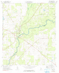
1974 Map of Newton
USGS Topo · Published 1991About this map
The Newton town site serves as the focal point of this Baker County landscape, situated along the winding banks of the Flint River. This survey captures the agricultural and riverine character of the region during the mid-1970s, where the river serves as the prominent boundary between Baker and Mitchell counties. Near the town center, several community institutions appear, including the County High Sch and a Gaging Station monitoring the river's flow near the corporate boundary.
Find a feature on this map
23 named features on this map. Tap any name to fly to it.
Don’t see what you’re looking for? This feature index may not catch every label — zoom into the map to look around manually.
Map Details
Editions of this 1974 Newton Map
2 editions found
Other maps of this area

1953 · Dothan
USGS Topo · 1:250,000

1954 · Dothan
USGS Topo · 1:250,000

1955 · Dothan
USGS Topo · 1:250,000

1956 · Baconton
USGS Topo · 1:62,500

1956 · Newton
USGS Topo · 1:62,500

1971 · Camilla
USGS Topo · 1:24,000

1971 · Hopeful
USGS Topo · 1:24,000
1971 · Branchville
USGS Topo · 1:24,000
1974 · Baconton South
USGS Topo · 1:24,000

1974 · Elmodel
USGS Topo · 1:24,000