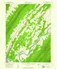
1959 Map of Newton Hamilton
USGS Topo · Published 1961About this map
The Juniata River winds through a landscape of sharp ridges and narrow valleys on this 1959 survey, serving as the primary corridor for the Pennsylvania railroad. Along its banks, the borough of Newton Hamilton and the edge of Mount Union anchor the local economy, supported by the intensive rail infrastructure of the 4 Tracks line. This river-and-rail corridor is further developed at Silver Ford Heights and the Methodist Training Camp, while the surrounding terrain is dominated by the massive Jacks Mountain and Tuscarora Mountain.
Find a feature on this map
53 named features on this map. Tap any name to fly to it.
Don’t see what you’re looking for? This feature index may not catch every label — zoom into the map to look around manually.
Map Details
Editions of this 1959 Newton Hamilton Map
3 editions found
Other maps of this area

1919 · Mattawana
USGS Topo · 1:62,500

1919 · Menno
USGS Topo · 1:62,500

1922 · Mt Union
USGS Topo · 1:48,000

1924 · Mt. Union
USGS Topo · 1:62,500

1924 · Lewistown
USGS Topo · 1:62,500

1927 · Lewisburg
USGS Topo · 1:62,500

1935 · Allensville
USGS Topo · 1:62,500

1936 · East Waterford
USGS Topo · 1:48,000

1938 · Allensville
USGS Topo · 1:62,500

1941 · East Waterford
USGS Topo · 1:62,500