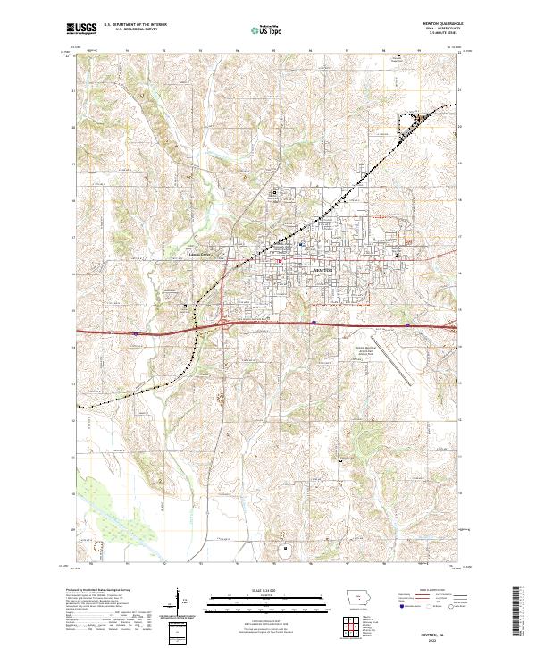
2022 Map of Newton
USGS Topo · Published 2022About this map
The town of Newton serves as the focal point of this Jasper County landscape, anchored by the Jasper County Courthouse at its center. This modern survey illustrates the town's northward and westward expansion, including the suburb of Lambs Grove and the extensive Des Moines Area Community College - Newton Campus. The southern portion of the quadrangle transitions into the drainage basin of the South Skunk River, where numerous seasonal creeks like Cardinal Cr and Cherry Cr carve through the agricultural fields.
Find a feature on this map
86 named features on this map. Tap any name to fly to it.
Don’t see what you’re looking for? This feature index may not catch every label — zoom into the map to look around manually.
Map Details
Editions of this 2022 Newton Map
This is the sole edition of this map. No revisions or reprints were ever made.
Other maps of this area

1954 · Des Moines
USGS Topo · 1:250,000

1956 · Des Moines
USGS Topo · 1:250,000

1957 · Des Moines
USGS Topo · 1:250,000

1965 · Prairie City
USGS Topo · 1:24,000

1965 · Newton
USGS Topo · 1:24,000

1965 · Monroe
USGS Topo · 1:24,000

1965 · Colfax
USGS Topo · 1:24,000

1969 · Des Moines
USGS Topo · 1:250,000
1975 · Baxter
USGS Topo · 1:24,000

1975 · Baxter SE
USGS Topo · 1:24,000