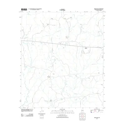
2012 Map of Newtonia
USGS Topo · Published 2012About this map
Newtonia and the nearby settlement of Mount Pleasant anchor this southwestern Mississippi landscape, characterized by a complex network of creeks feeding into the Buffalo River. The map reveals a dense distribution of family-named cemeteries and landmarks, suggesting a deeply rooted local history. Genealogists can identify numerous burial sites such as Netterville Cem, Hudson Cem, and Newman Cem scattered among the rural holdings. The presence of Forest Home Airport south of Newtonia adds a modern infrastructure element to an area otherwise defined by timbered creek bottoms and local roads like Old Hwy 24 and Bowling Green Rd. Waterways such as Jackson Cr, Matthews Cr, and Whittaker Cr provide a natural framework for the rural parcels and scattered homesteads throughout Wilkinson County.
Find a feature on this map
57 named features on this map. Tap any name to fly to it.
Don’t see what you’re looking for? This feature index may not catch every label — zoom into the map to look around manually.
Map Details
Editions of this 2012 Newtonia Map
This is the sole edition of this map. No revisions or reprints were ever made.
Other maps of this area

1906 · Bayou Sara
USGS Topo · 1:125,000

1936 · Woodville
USGS Topo · 1:62,500

1939 · St. Francisville
USGS Topo · 1:62,500

1941 · Norwood
USGS Topo · 1:31,680

1941 · Lost Creek
USGS Topo · 1:31,680

1945 · Norwood
USGS Topo · 1:31,680

1945 · Lost Creek
USGS Topo · 1:31,680

1953 · Natchez
USGS Topo · 1:250,000

1954 · Baton Rouge
USGS Topo · 1:250,000

1956 · Natchez
USGS Topo · 1:250,000