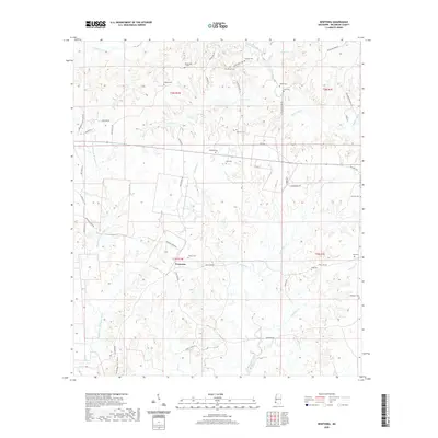
2020 Map of Newtonia
USGS Topo · Published 2020About this map
Newtonia sits at the heart of this Wilkinson County landscape, surrounded by an intricate network of waterways including the Buffalo River and Thompson Creek. The settlement pattern is defined by family-named routes and landholdings, visible in labels like Judydahl Plantation Rd, Coons Hill Rd, and Hiram McGraw Rd. This map is particularly significant for genealogists, as it meticulously records over a dozen family burial grounds distributed across the townships. From the Netterville Cem in the north to the Whitaker Cem in the southeast, these sites preserve the locations of early area residents. The terrain is deeply carved by numerous drainages, such as Jews Cr and Whitaker Cr, which have historically dictated the placement of homesteads and the winding paths of rural roads like Ancil Cox Rd.
Find a feature on this map
55 named features on this map. Tap any name to fly to it.
Don’t see what you’re looking for? This feature index may not catch every label — zoom into the map to look around manually.
Map Details
Editions of this 2020 Newtonia Map
This is the sole edition of this map. No revisions or reprints were ever made.
Other maps of this area

1906 · Bayou Sara
USGS Topo · 1:125,000

1936 · Woodville
USGS Topo · 1:62,500

1939 · St. Francisville
USGS Topo · 1:62,500

1941 · Norwood
USGS Topo · 1:31,680

1941 · Lost Creek
USGS Topo · 1:31,680

1945 · Norwood
USGS Topo · 1:31,680

1945 · Lost Creek
USGS Topo · 1:31,680

1953 · Natchez
USGS Topo · 1:250,000

1954 · Baton Rouge
USGS Topo · 1:250,000

1956 · Natchez
USGS Topo · 1:250,000