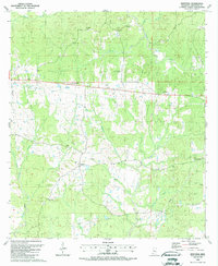
1988 Map of Newtonia
USGS Topo · Published 1988About this map
The Buffalo River and its numerous tributaries, including Jackson Creek and Matthews Creek, shape this landscape in Wilkinson County. The settlement patterns in this area are defined by small crossroads and a dense concentration of family burial grounds and community churches. Genealogists will find a wealth of specific local data, from the Netterville Cem in the north to the Whitaker Cem in the southeast.
Find a feature on this map
40 named features on this map. Tap any name to fly to it.
Don’t see what you’re looking for? This feature index may not catch every label — zoom into the map to look around manually.
Map Details
Editions of this 1988 Newtonia Map
This is the sole edition of this map. No revisions or reprints were ever made.
Other maps of this area

1906 · Bayou Sara
USGS Topo · 1:125,000

1936 · Woodville
USGS Topo · 1:62,500

1939 · St. Francisville
USGS Topo · 1:62,500

1941 · Norwood
USGS Topo · 1:31,680

1941 · Lost Creek
USGS Topo · 1:31,680

1945 · Norwood
USGS Topo · 1:31,680

1945 · Lost Creek
USGS Topo · 1:31,680

1953 · Natchez
USGS Topo · 1:250,000

1954 · Baton Rouge
USGS Topo · 1:250,000

1956 · Natchez
USGS Topo · 1:250,000