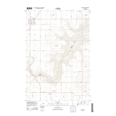
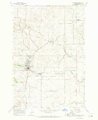
2013 Map of Nezperce
USGS Topo · Published 2013About this map
Nezperce serves as the primary hub in this portion of Lewis County, situated on an upland plateau defined by a grid of agricultural access roads like Miller Rd and Syron Rd. The terrain breaks sharply to the south and east where the deep incision of Lawyers Canyon creates a natural boundary between Lewis and Idaho counties. This dramatic shift in topography is carved by Lawyer Cr, which transitions the landscape from the orderly farm plots near the Nez Perce Municipal Airport to the steep, winding drainage systems of Syron Draw and Red Rock Cr.
Find a feature on this map
30 named features on this map. Tap any name to fly to it.
Don’t see what you’re looking for? This feature index may not catch every label — zoom into the map to look around manually.
Map Details
Editions of this 2013 Nezperce Map
This is the sole edition of this map. No revisions or reprints were ever made.
Other maps of this area

1924 · Kamiah
USGS Topo · 1:125,000

1955 · Pullman
USGS Topo · 1:250,000

1958 · Pullman
USGS Topo · 1:250,000
1967 · Nezperce SE
USGS Topo · 1:24,000

1967 · Mohler
USGS Topo · 1:24,000
1967 · Kamiah
USGS Topo · 1:24,000
1967 · Nezperce SW
USGS Topo · 1:24,000

1967 · Sixmile Creek
USGS Topo · 1:24,000

1967 · Cottonwood NE
USGS Topo · 1:24,000
1967 · Cottonwood
USGS Topo · 1:24,000