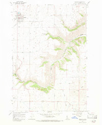
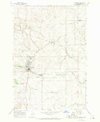
1967 Map of Nezperce
USGS Topo · Published 1971About this map
Nezperce serves as the focal point of this Lewis County landscape, which lies entirely within the Nez Perce Indian Reservation. The settlement pattern here reflects the agricultural and topographical constraints of the Camas Prairie, where deep drainages like Lawyer Creek and its tributaries—including Suzie Creek and Mitchell Creek—carve through the high plateau. The map captures the infrastructure of the late 1960s, noting functional landmarks such as a Gaging Station and Sewage Disposal Ponds near the town center.
Find a feature on this map
16 named features on this map. Tap any name to fly to it.
Don’t see what you’re looking for? This feature index may not catch every label — zoom into the map to look around manually.
Map Details
Editions of this 1967 Nezperce Map
This is the sole edition of this map. No revisions or reprints were ever made.
Other maps of this area

1924 · Kamiah
USGS Topo · 1:125,000

1955 · Pullman
USGS Topo · 1:250,000

1958 · Pullman
USGS Topo · 1:250,000
1967 · Nezperce SE
USGS Topo · 1:24,000

1967 · Mohler
USGS Topo · 1:24,000
1967 · Kamiah
USGS Topo · 1:24,000
1967 · Nezperce SW
USGS Topo · 1:24,000

1967 · Sixmile Creek
USGS Topo · 1:24,000

1967 · Cottonwood NE
USGS Topo · 1:24,000
1967 · Cottonwood
USGS Topo · 1:24,000