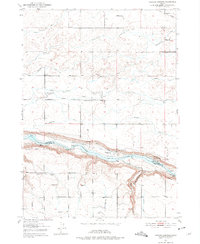
1950 Map of Niagara Springs
USGS Topo · Published 1975About this map
The Snake River carves a dramatic path through this 1950 survey, forming the natural boundary between Gooding and Twin Falls counties. The landscape is defined by the intersection of industrial transport and complex water management, with the Union Pacific railroad and the Bob Barton Highway facilitating movement across the plateau. High above the river, an intricate network of Irrigation Ditches and specialized infrastructure like a Seepage Tunnel and a Pipe Line support the agricultural character of the region.
Find a feature on this map
21 named features on this map. Tap any name to fly to it.
Don’t see what you’re looking for? This feature index may not catch every label — zoom into the map to look around manually.
Map Details
Editions of this 1950 Niagara Springs Map
2 editions found
Other maps of this area

1949 · Thousand Springs
USGS Topo · 1:24,000

1949 · Tuttle
USGS Topo · 1:24,000

1950 · Niagara Springs
USGS Topo · 1:24,000

1950 · Filer
USGS Topo · 1:24,000

1950 · Jerome
USGS Topo · 1:24,000

1950 · Jerome
USGS Topo · 1:62,500

1951 · Thousand Springs
USGS Topo · 1:24,000

1951 · Tuttle
USGS Topo · 1:24,000

1951 · Clover
USGS Topo · 1:24,000

1954 · Thousand Springs
USGS Topo · 1:24,000