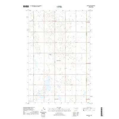
2020 Map of Niagara SW
USGS Topo · Published 2020About this map
The Goose River and Goose Cr define the drainage of this prairie landscape, where agricultural land use is organized by a strict grid of section lines and county roads. Two local burial sites, Adler Union Cem in the northwest and Logan Cem near the center, serve as important focal points for genealogical research in this rural portion of the Red River Valley region. Large water bodies including Rugh Lake, Horseshoe Lake, and Hillesland Lake dot the southern half of the map, suggesting the glacial pothole topography characteristic of the area. A small private landing strip, Ricketyback Field, sits west of the Goose Cr, illustrating the modern aviation requirements of remote farming operations.
Find a feature on this map
36 named features on this map. Tap any name to fly to it.
Don’t see what you’re looking for? This feature index may not catch every label — zoom into the map to look around manually.
Map Details
Editions of this 2020 Niagara SW Map
This is the sole edition of this map. No revisions or reprints were ever made.
Other maps of this area

1939 · Niagara
USGS Topo · 1:62,500

1942 · McVille
USGS Topo · 1:62,500

1952 · Grand Forks
USGS Topo · 1:250,000

1952 · New Rockford
USGS Topo · 1:250,000

1956 · New Rockford
USGS Topo · 1:250,000

1956 · Grand Forks
USGS Topo · 1:250,000

1963 · Niagara SW
USGS Topo · 1:24,000
1963 · McVille SE
USGS Topo · 1:24,000
1963 · Niagara
USGS Topo · 1:24,000

1963 · Logan Center
USGS Topo · 1:24,000